

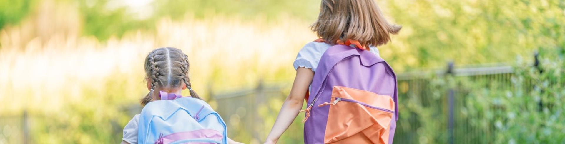
The City is taking steps to improve safety around schools and playgrounds. The purpose of the Safe Routes to School program is to create a safe environment for students to walk, wheel and roll to school. This process involves working in collaboration with the entire school community to identify ways to make active travel safer and easier.
Watch for these at Your School
Here are some ideas to make active travel easy and fun. These methods help build confidence for kids to travel independently, while reducing congestion at the front of the school.
With the return to school and increased activity around school zones, the City of Penticton and Penticton RCMP are reminding drivers to slow down, stay alert and watch for increased pedestrian and cyclist traffic near schools.
School zone speed limits of 30 km/h are in effect at all times, unless otherwise posted. Drivers are encouraged to give themselves extra time, avoid distractions and use extra caution around crosswalks, intersections, and school drop-off areas.
Remember:
- Do not make U-turns within school zones.
- Park and stop only in designated areas.
- Stop for school buses when red lights are flashing.
- Watch for children who may unexpectedly enter the roadway.
- Always have children enter and exit vehicles from the sidewalk side and never cross mid-block.
The City's Bylaw Services team and Penticton RCMP will be monitoring high-traffic school areas throughout the school year to help keep students safe.
A ‘Kiss & Go' zone is a short-term stopping area where drivers can park for a short time – no longer than two minutes – while the student exits the vehicle. This keeps a steady flow of vehicles moving.
A walking or biking school bus is just like a traditional school bus – but on foot or bike. Students walk or ride together along a designated route, picking up friends along the way. Each route is led by trained adult walk leaders who ensure a safe, active and social trip to and from school every day.
A walking school bus service is being provided for Skaha Elementary by the Society for Children and Youth of BC, with more information available on their website and an application form for families interested in participating. The group is recruiting parent and community volunteers and is interested in exploring other opportunities to offer the program at other South Okanagan schools.
Walking School Bus Guides:
These designated ‘Drive to Five’ spots are located five minutes (500 metres) away from the school, where parents can drop off or pick up their kids. This encourages walking for short distances, while helping to reduce congestion near the front of the school. This saves you time and builds student confidence to walk independently.
Drive to Five planning guide examples:
IMPORTANT: The speed limits within Penticton school and playground zones are now 30km/h at all times – 24 hours a day, seven days a week.
The speed limits within Penticton school and playground zones are now 30km/h at all times – 24 hours a day, seven days a week. These changes reflect the fact that school facilities are key community amenities that are often used outside regular school hours, including evenings and weekends. The changes also enable City staff to add traffic calming measures, such as speed humps, which previously wouldn’t have been suitable due to a need to allow for higher speed in the off-hours.
The changes are in response to the City’s ‘Safe Routes to School’ studies, community safety concerns and resident feedback gathered through the Transportation Master Plan engagement process.
Drive to Five planning guides
Walking School Bus guides
Other Resources
Skaha Lake Elementary
Construction along Green Avenue will be complete ahead of the return to school, with new traffic safety measures in place for anyone walking, riding, scootering or driving. Drivers are reminded to slow down, allow extra time and look for the posted 'Kiss & Go' zones for drop-off and pickup.
A walking school bus is just like a traditional school bus – but on foot. Students walk or ride together along a designated route, picking up friends along the way. Each route is led by trained adult walk leaders who ensure a safe, active and social trip to and from school.
The Society for Children and Youth of BC is providing a walking school bus service for students at Skaha Elementary. More information available on their website and an application form for families interested in participating. The group is recruiting parent and community volunteers.
The following map has been updated with the latest information ahead of the return to school in September 2026.
Safe Routes Brochure
A ‘Kiss & Go' zone is a short-term stopping area where drivers can park for a short time – no longer than two minutes – while the student exits the vehicle. This keeps a steady flow of vehicles moving.
With the closure of Parkway Elementary, plus the transition of Skaha Middle School to an elementary school, this Safe Routes to School plan identifies the following two goals.
1: Improve safety and accessibility along routes to school
This goal focuses on safety for all modes (walking, cycling, rolling, transit, and driving). Further detail is provided in the action plan. Infrastructure on routes to school should encourage slower vehicle speeds, make active users more visible, and separate modes where appropriate.2: Facilitate the transition from Parkway Elementary to Skaha Lake Elementary
This goal focuses on ensuring that caregivers and children travelling from the Parkway Elementary area feel confident on their route to school and when crossing major intersections. Actions in the action plan should encourage children and families to continue or start using active modes as an alternative to a vehicle.
Here are some of the recommendations made in the report:
- Implement 'Drive to Five' locations to support improved pick-up, drop-off at school and encourage walking.
- Upgrade the Skaha Lake Road / Green Avenue and mid-block crosswalks to improve pedestrian visibility and reduce crossing distances.
- Explore sidewalk improvements and traffic calming (specific locations suggested in the report).
- A 'Walking School Bus' could facilitate group travel to and from the school.
- Install new bike racks in high-visibility locations.
- Work with teachers to add active and sustainable transportation-related content into regular coursework and lectures. Incorporate BC Transit’s Ready to Roll transit education program into lessons and special events (such as Earth Day or other environmental events).
- Use active and sustainable transportation whenever possible when travelling for school field trips.
- Make regular announcements and mount posters at school encouraging students to walk, bike, and take transit to school and related events to keep active and sustainable transportation top of mind and highlight its benefits.
- Participate in active transportation events and programs including Go By Bike Week.
The full report can be downloaded here.
This process involved:
- Meetings with the school administration and parent advisory committee.
- Site visit to better understand transportation challenges and opportunities.
- Neighbourhood walkabout to explore well-used routes and brainstorm opportunities. Attendees included the project team, school administration, caregivers and students.
- Survey of school community to better understand travel modes, behaviours and concerns.
- ‘Hands up’ surveys in classrooms and student visioning workshops.
- Safe Routes to School Plan prepared.
- Brochure & map of best routes to school.
KVR Elementary
Safety improvements have been made around KVR Elementary ahead of the return to school, including installing a new multi-use path along Manitoba Street, suitable for biking, scootering and walking. In addition, new crosswalks and other traffic safety measures have been implemented throughout this corridor to slow vehicles and ensure safe travel for everyone on foot or wheels.
The following map has been created ahead of the return to school in September 2026.
Safe Routes Brochure
A ‘Kiss & Go' zone is a short-term stopping area where drivers can park for a short time – no longer than two minutes – while the student exits the vehicle. This keeps a steady flow of vehicles moving.
The plan identifies opportunities to improve safety, support active transportation and reduce congestion around the school. The findings are based on feedback from students, families, school staff and the Parent Advisory Committee.
The plan identifies several high-priority actions to improve safety and support active transportation, including:
- Construction of the Manitoba Street multi-use path and traffic calming improvements. (now complete)
- Implementation of Drive to Five+ locations and support for the Walking School Bus program.
- Additional traffic calming measures and safety improvements near school crossings.
- Improved pedestrian crossings and sidewalks.
- Enhanced visibility and safety improvements at the Main Street and Jermyn Avenue crossing.
- Increased bike and scooter parking at the school.
- Walking School Bus programs and active transportation education initiatives.
Key concerns identified
- Unsafe driver behaviour and congestion during drop-off and pick-up periods.
- Main Street, Manitoba Street and Duncan Avenue East were identified as areas where families experience traffic safety concerns.
- Caregivers noted concerns with speeding, motorists failing to yield at crossings, limited crossing opportunities and visibility issues caused by vehicles parked near intersections.
- Missing sidewalk connections and a lack of dedicated cycling facilities were also identified as barriers to walking, rolling and biking to school.
This process involved:
- Meetings with the school administration and parent advisory committee.
- Site visit to better understand transportation challenges and opportunities.
- Neighbourhood walkabout to explore well-used routes and brainstorm opportunities. Attendees included the project team, school administration, caregivers and students.
- Survey of school community to better understand travel modes, behaviours and concerns.
- ‘Hands up’ surveys in classrooms and student visioning workshops.
- Safe Routes to School Plan prepared.
- Brochure & map of best routes to school.
Wiltse Elementary
Construction is now wrapping up on Balsam Avenue, next to Wiltse Elementary, with a number of safety improvements in place including installing a new sidewalk along Balsam Avenue to the daycare and the school. Review the report findings below for further information outlining opportunities to enhance safety around the school.
The following map has been created ahead of the return to school in September 2026.
Safe Routes Brochure
The Safe Routes to School Plan identified several high-priority improvements to support safer travel for students:
- Establish and promote Drive to Five+ locations and designated Kiss and Go areas to reduce congestion near the school.
- Improve pedestrian crossings at key locations, including:
- Pineview Road and Dartmouth Drive
- Balsam Avenue and Cedar Road
- Complete sidewalk connections along Balsam Avenue to create a continuous walking route to the school (completed in September 2026).
- Implement additional traffic calming measures on Balsam Avenue to address speeding concerns (completed in September 2026). .
- Explore measures to reduce unsafe U-turn movements and improve traffic circulation near the school.
Goals
- Improve safety and infrastructure along active routes to school.
- Encourage safe driver behaviour, particularly during pick-up and drop-off times.
- Increase the use of active transportation through education, promotion, and improved facilities.
Safety and Infrastructure Concerns
- Excessive vehicle congestion during school pick-up and drop-off times.
- Concerns about speeding on Wiltse Boulevard, Balsam Avenue, Pineview Road and other neighbourhood streets.
- Missing sidewalks and gaps in the pedestrian network were identified on several routes leading to the school, particularly on Balsam Avenue and nearby residential streets.
- Caregivers expressed concerns about driver behaviour, illegal parking, blocked sightlines and unsafe U-turns during drop-off and pick-up periods.
- Limited cycling infrastructure and a lack of safe crossings on key routes.
This process involved:
- Meetings with the school administration and parent advisory committee.
- Site visit to better understand transportation challenges and opportunities.
- Neighbourhood walkabout to explore well-used routes and brainstorm opportunities. Attendees included the project team, school administration, caregivers and students.
- Survey of school community to better understand travel modes, behaviours and concerns.
- ‘Hands up’ surveys in classrooms and student visioning workshops.
- Safe Routes to School Plan prepared.
- Brochure & map of best routes to school.
Queen's Park Elementary
The following map has been created ahead of the return to school in September 2026.
View the Safe Routes Brochure
Community engagement included caregiver surveys, student travel surveys, PAC meetings and site observations during school pick-up and drop-off times. Walking is a common mode of travel for Queen’s Park students, although student survey data shows driving remains the primary travel mode for many families.
The plan identified several high-priority improvements to support safer travel for students.
- Formalize a Drive to Five+ location and promote designated Kiss and Go areas to reduce congestion near the school.
- Install a raised crosswalk at the Birch Avenue and Bassett Street intersection to improve pedestrian connectivity and safety.
- Improve safety and visibility at Birch Avenue and Maple Street through curb extensions or similar measures to address sightline concerns.
- Add new pedestrian crossings along Wade Avenue and Orchard Avenue to create safer routes for students.
- Expand the 30 km/h speed zone and implement additional traffic calming measures on Birch Avenue and surrounding school routes.
- Install additional bicycle and scooter parking to support increasing active transportation use.
Safety and Infrastructure Concerns
- Unsafe driver behaviour, speeding and a lack of enhanced crosswalks.
- Crossing busy roads such as Wade Avenue and Eckhardt Avenue can be challenging due to traffic volumes and vehicle speeds.
- Gaps in the sidewalk network and limited pedestrian connections create barriers for students walking to school.
- Families identified opportunities to improve cycling connections and create safer routes for students riding to school.
- Vehicles parked near intersections can reduce visibility and create safety concerns for both pedestrians and drivers.
This process involved:
- Meetings with the school administration and parent advisory committee.
- Site visit to better understand transportation challenges and opportunities.
- Neighbourhood walkabout to explore well-used routes and brainstorm opportunities. Attendees included the project team, school administration, caregivers and students.
- Survey of school community to better understand travel modes, behaviours and concerns.
- ‘Hands up’ surveys in classrooms and student visioning workshops.
- Safe Routes to School Plan prepared.
- Brochure & map of best routes to school.
Uplands Elementary
The following map has been created ahead of the return to school in September 2026.
Download the Uplands Elementary Map
Safe Routes Brochure
The following suggestions are pulled from the Safe Routes to School report. You can read the full study here.
Here are some of the opportunities and recommendations (review the report for the full list):
- Implement Drive to Five+ locations to support improved pick-up, drop-off at school and encourage walking. This will help reduce congestion near the school frontage during pick-up and drop-off times.
- Organize Walking School Bus groups to facilitate group travel for students walking and cycling along the Kettle Valley Rail Trail.
- Work with teachers to add active and sustainable transportation-related content into regular coursework and lectures. Incorporate BC Transit’s Ready to Roll transit education program into lessons and special events (such as Earth Day or other environmental events).
- Use active and sustainable transportation whenever possible when travelling for school field trips.
- Make regular announcements and mount posters at school encouraging students to walk, bike, and take transit to school and related events to keep active and sustainable transportation top of mind and highlight its benefits.
- Participate in active transportation events and programs including Go By Bike Week.
- Pathway improvements, new sidewalk installations, traffic calming throughout the area and the option of adding centre median posts on Middle Bench Road to prevent U-turns.
- Conduct intersection and pedestrian crossing improvements near the school. Review side streets along Best Routes to Uplands Elementary and implement traffic calming, which could include stop signs at all intersections, curb extensions, leading pedestrian interval at major intersections, turn restrictions and speed reductions.
- Explore changes to school parking lot.
- Install centre median flex posts on Middle Bench Road to prevent U-turns.
- Review opportunity to reduce speed limit permanently to 30km/hr along major corridors in proximity to the school (Middle Bench Road and Johnson Road).
- Explore the feasibility of installing a sidewalk on the north side of Johnson Street.
- Work with RCMP to enforce speeds and other road safety concerns in the school area.
- Explore feasibility of filling in sidewalk gaps on Westminster Avenue from Townley Street to MacDonald Street.
This process involved:
- Meetings with the school administration and parent advisory committee.
- Site visit to better understand transportation challenges and opportunities.
- Neighbourhood walkabout to explore well-used routes and brainstorm opportunities. Attendees included the project team, school administration, caregivers and students.
- Survey of school community to better understand travel modes, behaviours and concerns.
- ‘Hands up’ surveys in classrooms and student visioning workshops.
- Safe Routes to School Plan prepared.
- Brochure & map of best routes to school
Progress Made
Construction began in July 2024 along Middle Bench Road to install new sidewalks, raised crosswalks and other safety measures outside Uplands Elementary school.
The City committed roughly $300k to complete the sidewalk network on Middle Bench Road adjacent to the school frontage as part of the 2024 budget. The safety improvements included installing sidewalks on both sides of the road, raised crosswalks and curbs. In addition, the City added storm infrastructure to prevent future flooding.
Other infrastructure action items include addressing sidewalk gaps along Westminster Ave E (a key route), addressing u-turning in front of the school, adding more road markings and signage, and working with the SD 67 to formalize access through the back of the school property.
The full action plan can be found on Page 23 of the Uplands Plan, and staff will continue to work collaboratively with the school administration and the community to implement these actions.

Columbia Elementary
The following map has been created ahead of the return to school in September 2026.
Download the Columbia Elementary map
Safe Routes Brochure
Here are some of the recommendations made in the report:
- Formalize 'Drive to Five' locations to support improved pick-up, drop-off at school and encourage walking.
- Consider extending the 30km/h speed zone to include all roads around the school area (Columbia Street, Lawrence Avenue, and Duncan Avenue) with appropriate enforcement and traffic calming measures to support lower vehicle speeds. Consideration for the broader neighbourhood should also be considered.
- Explore feasibility to reduce vehicle speeds along the corridor and improve the pedestrian crossing experience. Potential solutions could include raised crosswalks and/or curb extensions at desired crossing points.
- Install new bike racks in high-visibility locations.
- Explore sidewalk improvements and traffic calming (specific locations suggested in the report).
- Improve visiblity and awareness of pedestrian crosswalks.
- Promote Kiss 'n' Go locations.
- Work with teachers to add active and sustainable transportation-related content into regular coursework and lectures. Incorporate BC Transit’s Ready to Roll transit education program into lessons and special events (such as Earth Day or other environmental events).
- Use active and sustainable transportation whenever possible when travelling for school field trips.
- Make regular announcements and mount posters at school encouraging students to walk, bike, and take transit to school and related events to keep active and sustainable transportation top of mind and highlight its benefits.
- Participate in active transportation events and programs including Go By Bike Week.
The full report can be downloaded here.
This process involved:
- Meetings with the school administration and parent advisory committee.
- Site visit to better understand transportation challenges and opportunities.
- Neighbourhood walkabout to explore well-used routes and brainstorm opportunities. Attendees included the project team, school administration, caregivers and students.
- Survey of school community to better understand travel modes, behaviours and concerns.
- ‘Hands up’ surveys in classrooms and student visioning workshops.
- Safe Routes to School Plan prepared.
- Brochure & map of best routes to school (coming soon).
Penticton Secondary
Eckhardt Avenue, which has been under construction, will reopen to the public ahead of the return to school. Drivers are reminded to slow down as everyone gets used to the traffic pattern changes. The posted speed around school zones remains 30 km/h at all times throughout Penticton.
Further Information
To create safe and healthy modes of active transportation
In 2021, the City of Penticton adopted a Transportation Master Plan (TMP) that seeks to create and manage a safe transportation system that supports all ages, abilities and modes of transportation. A key goal identified in the TMP is to ensure residents and workers throughout Penticton have the opportunity to walk to parks, schools, shopping, jobs and other destinations in safety and comfort.
To work toward our climate goals
Converting vehicle trips to active trips is a key goal in the Community Climate Action Plan, which notes that 54% of our community emissions are created by vehicles. In addition to electrification, in order to achieve the targets in the Community Climate Action Plan relating to vehicle emissions, the City is striving to reduce vehicle kilometres travelled by 13%. The City plans to do this by:
• Eliminating approximately a quarter of the kilometers travelled by better land use planning (locating housing close to services/commercial)
• Converting almost half of the kilometers travelled to active transportation (biking, walking, scooters etc)
• Converting the remaining quarter to transit trips
The Safe Routes to School Program is designed to support students and their families to walk, bike or roll to and from school, which is in direct alignment with the Community Climate Action Plan goals.To meet our strategic priorities
The Safe Routes to School program meets the following City Council strategic priorities.
Safe & Resilient: The City of Penticton will enhance and protect the safety of all residents and visitors to Penticton.
Livable & Accessible: The City of Penticton will proactively plan for deliberate growth; focused on an inclusive, healthy, safe and desirable place to live.Background
In 2023, the City of Penticton partnered with Carmi Elementary and Uplands Elementary on a pilot project to help identify safe routes to school using active transportation. Through public engagement and based on best practices, the plan supports safe and comfortable environments for students to walk, wheel and roll to school wherever possible.
The plans are living documents that will be reviewed annually by the City with the schools and will be used to develop an action and management plan for infrastructure upgrades identified through this process.
Following the successful pilot, the City has been rolling out studies to two schools each year.
What the Study Involves
Each school plan will be unique to the school, particularly when it comes to the infrastructure changes that are necessary in each area to support it. However, there are elements and key outcomes that will be replicated for all plans, including:
Developing a brochure to provide to the school that outlines the “safe routes” and highlights infrastructure available to support those routes (ex. crosswalks, sidewalks, trails, etc).
Introducing “Drive to Five” areas. These are areas that provide additional opportunities for parents to park and walk/drop-off children within a five-minute walk/ride to the school to reduce congestion in and around the schools as well as the added physical benefits.
Introducing a “Walking School Bus” or “Bike Bus.”
And more!
HEALTH: Staying active is good for your child’s physical and mental health.
SOCIAL DEVELOPMENT: Spending time together outside promotes positive connections with friends and family.
SMART MOVES: Students who walk or roll to school arrive more alert and ready to learn.
ENVIRONMENT: Reducing the number of car trips decreases greenhouse gas emissions, traffic congestion and parking problems.
INDEPENDENCE: Active travel builds confidence.
The School Neighbourhood Activation Playbook (SNAP) was prepared under the direction of TransLink and the BC Ministry of Transportation and Transit (MOTT) with the participation and valuable input of interest holders across British Columbia, Canada, and internationally, including municipal staff, regional Health Authorities, researchers, and not-for-profit organizations working in health, transportation, and education.
The Safe Routes to School Plan will be a joint effort to implement infrastructure, programs and educational materials. An action plan will be included in the Safe Routes to School Plan that identifies responsibilities for action by various stakeholders including the City of Penticton, the School District, school administration and the Parent Advisory Committee.
- Sept. 3, 2026: School's back Sept. 8: Slow down and watch for more kids on the move
- Aug. 25, 2025: Watch for more kids walking or rolling to school starting September 2
- March 28, 2025: City eyes two more schools as it expands its Safe Routes to School program
- Oct. 7, 2024: City working to create safer routes to schools
- Aug. 15, 2024: Watch for traffic changes around schools and playgrounds
- July 3, 2024: New sidewalks and crosswalks being installed outside Uplands Elementary
- May 22, 2024: City takes steps to improve safety around schools and playgrounds
- May 2024: Carmi Elementary Safe Routes to School report
- May 2024: Uplands Elementary Safe Routes to School report
- May 29, 2023: City launches pilot project to create safer routes to schools
- Details about the engagement process (now closed) can be found at shapeyourcitypenticton.ca
- Safe Routes to School background fact sheet
The following suggestions are pulled from the Carmi Elementary Safe Routes to School report. You can read the full study here. Many of these findings have been incorporated into the KVR Elementary School Safe Routes Plan.
Here are some of the recommendations made in the report:
- Implement Drive to Five locations to support improved pick-up, drop-off at school and encourage walking.
- Review side streets along Best Routes to Uplands Elementary and implement traffic calming, which could include stop signs at all intersections, curb extensions, leading pedestrian interval at major intersections, turn restrictions and speed reductions.
- Install new bike racks that have better security features in high visibility locations.
- Explore feasibility to reduce vehicle use and speeds
along Manitoba Street corridor and support active transportation facilities, including bikeways and improved sidewalk facilities. - Organize Walking School Bus groups to facilitate group travel from Drive to Five Locations to Carmi Elementary.
- Work with teachers to add active and sustainable transportation-related content into regular coursework and lectures. Incorporate BC Transit’s Ready to Roll transit education program into lessons and special events (such as Earth Day or other environmental events).
- Use active and sustainable transportation whenever possible when travelling for school field trips.
- Make regular announcements and mount posters at school encouraging students to walk, bike, and take transit to school and related events to keep active and sustainable transportation top of mind and highlight its benefits.
- Participate in active transportation events and programs including Go By Bike Week.
Have Questions?
Contact the City's Engineering department at engineering@penticton.ca
